The purpose of the Honolulu Rail Transit Project is to provide high-capacity rapid transit in the highly congested east-west transportation corridor between Kapolei and University of Hawai‘i at Mānoa (UH Mānoa), as specified in the O‘ahu Regional Transportation Plan (ORTP) (O‘ahu MPO 2007). The Project is intended to provide faster, more reliable public transportation service in the study corridor, where people of limited income and an aging population live. This can be achieved with buses operating in congested mixed-flow traffic to serve rapidly developing areas. The Project will also provide additional transit capacity, an alternative to private automobile travel, and improve transit links within the corridor.
HART oversees the design and construction of Skyline, while the City’s Department of Transportation Services (DTS) oversees operations and maintenance of Skyline.
For information on the HOLO card, fares, and schedules, please visit the City’s Department of Transportation Services (DTS) website:
- Visit Honolulu.gov/Skyline, or email skyline@honolulu.gov
- Call Skyline Customer Service at 808-848-5555 (option 4)
The Honolulu Rail Transit Project is being built in three operating segments:
SKYLINE SEGMENTS 1 & 2 (East Kapolei to Middle Street) //
Skyline Segments 1 and 2 are now open, providing service from East Kapolei to Middle Street.
Skyline is an automated, driverless rail system operating along approximately 15 miles of elevated guideway, with the exception of a 0.6-mile at-grade section at Hālaulani (Leeward Community College) Station. The system includes 13 stations, 19 four-car trains, and a Rail Operations Center.
Skyline is powered by electricity through a third-rail system. The City’s Department of Transportation Services (DTS) is responsible for operating and maintaining Skyline, as well as the City’s bus and paratransit services. The Honolulu Authority for Rapid Transportation (HART) is responsible for the design and construction of the rail system, known as “Skyline.”
SEGMENT 3 (Middle Street to Civic Center) //
Utility Relocations: Utility relocation work along Dillingham Boulevard continues to move forward. Roadway improvements, including road widening and paving, are also ongoing. Utility work along Dillingham Boulevard is expected to be completed by the end of 2026.
The August 2025 groundbreaking for the City Center Guideway and Stations (CCGS), also known as Segment 3, marked the start of the next major phase of work. This phase includes the design and construction of approximately three miles of elevated guideway and six stations: Mokauea (Kalihi), Niuhelewai (Honolulu Community College—Kapālama), Kūwili (Iwilei), Hōlau (Chinatown), Kuloloia (Downtown), and Kaʻākaukukui (Civic Center).
In October 2025, contractor Tutor Perini Corporation began major drilling operations in Iwilei along Kaʻaahi Street and in Downtown Honolulu along Nimitz Highway. In December 2025, the contractor also completed construction of a temporary trestle at Awa Street to support shaft drilling activities in the Nuʻuanu Stream.
With foundation work well underway, construction of the first above-ground column is anticipated by the end of the first quarter of 2026. Throughout 2026, vertical elements of the guideway are expected to emerge along the corridor, with columns rising from newly completed shafts and providing the community with its first look at the future elevated structure in Segment 3.
Segment 3 is currently scheduled to be ready for passenger service in 2031.
As part of the station design process, HART and Tutor Perini Corporation are hosting Neighborhood Design Workshops to gather community input on each of the six future CCGS stations. The first round of workshops for all six stations was completed in November 2025. The second and final round began in December 2025 and will continue through early 2026.
*Construction activities, schedules, and traffic impacts are subject to change.
Segment 3, also known as the City Center Guideway and Stations (CCGS) construction segment, includes six stations: Kalihi, Honolulu Community College-Kapālama, Iwilei, Chinatown, Downtown, and Civic Center.
The decision to exclude escalators from stations in Segment 3 was driven by a commitment to reduce capital costs of construction and long term maintenance.
From an operations and maintenance standpoint, feedback from the City’s Department of Transportation Services indicates that maintaining escalators in the first operating segment has presented ongoing challenges in terms of reliability and serviceability.
We want to emphasize that, while escalators will not be installed at Segment 3 stations, all stations will fully comply with State and City accessibility requirements, including those outlined in the Americans with Disabilities Act (ADA).
HART’s 2022 Recovery Plan proposed an amendment to the original Full Funding Grant Agreement (FFGA), a contract between the City and County of Honolulu and the Federal Transit Administration (FTA) executed in 2012. The initial FFGA provided $1.55B in federal funding and outlined the Project scope, 20 miles and 21 stations from East Kapolei to Ala Moana. HART’s 2022 Recovery Plan proposed to truncate the project scope from the original 20 miles and 21 stations to 18.9 miles and 19 stations from the East Kapolei Station to the Civic Center Station; the FTA accepted this plan in September 2022.
The 2022 Recovery Plan also proposed the deferral of the Pearl Highlands Parking Garage. The scope change required an amendment to the FFGA, which was necessary to maintain the funding needed to complete the remainder of the project.
Throughout 2023, HART collaborated with the FTA on amending the FFGA document, requiring approvals from various entities such as the U.S. Department of Transportation, the U.S. Congress, Governor’s Office, HART Board of Directors, City Council Committee on Budget, and Full City Council. The amended document was signed by Mayor Rick Blangiardi on February 1, 2024. On April 24, 2024, HART received $125M of the remaining $744M in federal funds, the first funding received under the FFGA since 2017.
Reaching Ala Moana is important because of the location of the Ala Moana Transit Center, the City’s largest bus transit center. More than 1,500 daily bus routes pass through Ala Moana Transit Center, where rail riders will be able to easily transfer to frequent bus service and continue their trips to Waikiki, University of Hawai‘i at Mānoa (UH Mānoa), Hawaiʻi Kai or elsewhere.
In 2007, the Honolulu City Council established the Locally Preferred Alternative (LPA) as a fixed guideway system between Kapolei and Ala Moana. In 2008, the City Council authorized planning, design and construction for the Minimum Operable Segment, which is that portion of the LPA between the University of Hawaiʻi-West Oʻahu and Ala Moana Center.
The Amended Full Funding Grant Agreement (FFGA) was finalized in February 2024 to have a temporary rail terminus at the Civic Center Station. However, the overall goal of reaching the Ala Moana Transit Center does not change.
The goal is still for the system to reach the Ala Moana Transit Center. Until then, enhanced bus services will be provided at the temporary rail terminus at the Civic Center Station and other Skyline stations to bring riders to their final destinations. Frequent bus services will be available at both the Downtown and Civic Center Stations, including some direct bus routes to Waikiki, University of Hawai‘i at Mānoa (UH Mānoa), and to the Ala Moana Transit Center, where connections to other buses can be made.
In the original ridership forecast for the Project, only about 10% of projected passengers were expected to have Kakaʻako or Ala Moana as their final destinations, meaning 90% would have exited rail before or at Civic Center Station, or transferred to a bus from Ala Moana.
Bus service from Downtown or the Civic Center will provide comparable connections for riders continuing beyond Ala Moana.
The City’s Department of Transportation Services (DTS) is responsible for the operation and maintenance of Skyline, along with the City’s bus and paratransit services.
For fare, HOLO card, or schedule information, visit Honolulu.gov/Skyline or call Skyline at 808-848-5555 (Option 4).
There are several reasons that a street-level rail system would not be feasible at this point of the Honolulu Rail Transit Project, including:
- That the rail system is powered via a “third rail”, which is a separate rail that runs alongside the tracks that carries 750 volts of electricity. Having a street-level system would require significant barriers to protect the public from the dangers of the third rail, which is currently achieved with the elevated guideway system.
- Additionally, the trains are expected to have an approximate six minute headway (the time between trains) during peak hours of operation. Meaning, for a street-level system, certain intersections all along the route would need to be closed to traffic and pedestrians at least every six minutes for a train to pass. This would create additional traffic congestion on our streets that is avoided with the elevated guideway.
The planned 1,600-stall parking garage at the Pearl Highlands Station will be deferred due to the excessive cost of construction at the originally planned location. However, HART and the City’s Department of Transportation Services (DTS) are committed to working together to find an alternative location for a garage. Several potential options have been discussed but much more research will need to be done before a plan can be developed.
In the meantime, DTS will add additional and enhanced bus service from North Shore and Central Oʻahu locations that will enable passengers to board the rail system at a planned bus transit center that will be built directly adjacent to the Pearl Highlands Station.
HART continues to be diligent to reduce the funding shortfall, and ultimately complete the Project to Ala Moana. Some ways that the shortfall is being addressed:
- Internal Cost Reductions: HART continues to look for ways to reduce its internal costs, including ways to improve efficiencies of internal processes, eliminate redundancies, and better manage costs. An example is a 2021 streamlining of the staffing organizational structure that will save $150–200M over the life of the project.
- Efficient Construction: HART is finding ways to lower construction costs. An example is the decision to implement a shift of a section of the guideway route along Dillingham Boulevard from the middle of the street to the mauka side, thereby eliminating the need to relocate certain utilities. This “mauka shift” will save approximately $150M.
- Alternative Technical Concepts (ATCs): HART is applying lessons learned from earlier segments to improve efficiency, control costs, and maintain high safety and performance standards. In Segment 3, the guideway and stations may look slightly different from those in Segments 1 and 2. ATCs create flexibility in design and construction while preserving key design features and keeping the project on budget.
- Risk Mitigation: Risk reduction actions have been implemented, and are evaluated on an ongoing basis, which will reduce future costs of procurement. A good example of risk mitigation is how HART worked to get the utility designs completed and approved before awarding the two recent utility relocation contracts. This will save construction costs and also shorten the work schedule, adding to the construction savings. In the past, HART had awarded contracts without approved final designs, which is a considerable risk to the contractors proposing on the construction work.
- Seeking New Funding: In addition to the Recovery Plan, HART continues seeking new revenue sources for the Project.
The Mauka Shift refers to a plan to move a section of the rail guideway from the center of Dillingham Boulevard to the mauka side of the street. This saves time and money for the Project by eliminating the need to relocate certain utilities.
Currently there is a complex web of electricity, water, sewer and fiber optics lines that run under Dillingham Boulevard. There are also two 138-kilovolt power transmission lines above ground on either side of Dillingham Boulevard. On the makai side, there are also 12- and 48-kilovolt power lines. It would be extremely difficult for HART to move all of these power lines underground as there is not enough room to provide the clearances needed from existing utilities. Moving the guideway to the mauka side of the street eliminates the need to bury all of the power lines on the makai side and avoids the need to move other existing underground utilities, thereby improving the Project schedule and reducing costs by approximately $150M.
The City Center Utilities Relocation project include the movement of utilities, such as water, sewer, gas, electrical, and communications infrastructure, and relocating overhead utilities underground, to prepare for construction of the rail guideway and stations in the Kalihi, Iwilei, Downtown, and Kakaʻako areas.
The project scope also includes roadway widening to accommodate the placement of the guideway which includes relocating sidewalks, street lights and traffic signals.
The work is divided into three contracts:
- Downtown Utilities Relocation (Kaʻaʻahi Street to Cooke Street): Ongoing since 2022; nearly complete.
- Dillingham Utilities Relocation (Middle Street to Kaʻaʻahi Street): Ongoing since 2022; expected to be completed late 2026.
- City Center Guideway and Stations Construction: Contract awarded in 2024; guideway shaft construction began summer 2025.
Yes, steel plates are used during construction. Contractors typically place compacted cold mix asphalt around the edges for an easy transition from the ground onto the plate, and tack weld plates together to reduce noise and provide a smoother surface for vehicles.
Work hours vary by project:
Downtown Utilities Relocation: Monday through Saturday, 7:00 am to 5:30 pm and 8 pm to 5 am.
Dillingham Utilities Relocation: Ongoing 24/7.
Guideway and Stations Construction: Monday through Friday (Saturdays as needed), 6:00 am to 5:00 pm. Nimitz Highway work will require night hours and will be announced once scheduled.
You can stay informed through the following sources:
- Visit the Traffic Updates and Alerts page for current lane closure information: https://honolulutransit.org/construction/traffic-updates/
- Sign up for HART’s eBlast newsletter at HonoluluTransit.org.
- Email info@honolulutransit.org
- Call HARTʻs public information hotline 808-566-2299
- Attend HART’s quarterly Business and Community Meetings, listed on the Upcoming Events calendar.
Skyline Segments 1 and 2, which run from Kaualakaʻi (East Kapolei) Station to Kahauiki (Middle Street Transit Center) Station, are open and operational.
The rail system is energized at all times. The third rail carries approximately 750 volts of electricity. Contact with the third rail is extremely dangerous and can be fatal. Skyline operations and maintenance are managed by the City’s Department of Transportation Services. For your safety, always follow posted signage and directions from station staff.
RAIL HAZARDS AND SAFETY TIPS
- Stay within designated public areas at all stations.
- Never enter restricted or secured rail areas or active work sites.
- Automated trains can move in either direction at any time and may approach without warning.
- Do not attempt to cut, climb over, or bypass fencing.
- Trespassing at rail facilities is prohibited and subject to enforcement under Hawaiʻi Revised Statutes (HRS §708-814).
- The rail system is monitored by more than 1,500 security cameras.
Construction areas and secured rail zones are not open to the public and are dangerous to enter.
In late 2020, it was discovered that there was a misalignment of the wheels and rails in the double-crossovers (also known as “frogs”) due to the wheels being too narrow. As a precaution, speed restrictions were put in place for all trains traveling through the double-crossovers. An independent industry expert was engaged to evaluate the situation and recommend a solution. The recommendation that was agreed to by HART, Department of Transportation Services (DTS), and Hawaii Department of Transportation (HDOT) included a short-term solution of performing a weld of the double-crossovers to fill the gap caused by the narrow wheels. The permanent solution is to replace the wheels. The welding work has been completed. Wheel replacements on the fleet of vehicles has begun. All trains will eventually be fitted with the new wheels.
It was also discovered that in certain areas of the double crossovers, the track gauge was too tight. The tracks have been adjusted and the gauge issue has been resolved. Based on the work that has been performed, tested and approved, the speed restrictions for the trains has been lifted and normal testing operations are underway.
An elevated guideway keeps trains separate from street traffic, reducing delays caused by cars, pedestrians, or other vehicles.
It also helps maintain a reliable schedule and reduces the rail system’s footprint by avoiding the need to acquire street-level space in busy corridors.
HART Weekly eBlast
Our weekly newsletter will keep you up-to-date about the project, news, construction, and information on upcoming events.
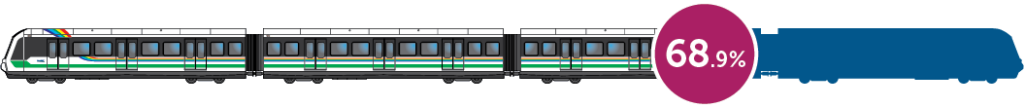
Project Status
The Overall Construction and Design Project Progress is based on the Estimate at Completion for the 2022 Recovery Plan scope to Ka‘ākaukukui (Civic Center) Station and the March 2031 Operational Readiness date.