Section 106
Section 106 of the National Historic Preservation Act of 1966 (NHPA) requires federal agencies to consider the effects on historic properties of projects they carry out, assist, fund, permit, license, or approve throughout the country. If a federal or federally-assisted project has the potential to affect historic properties, a Section 106 review will take place. The review process gives participating agencies, interested parties, and the public the chance to weigh in on these matters before a final decision is made.
Programmatic Agreement (PA)
In January 2011, after extensive consultation and negotiations with stakeholders and the community, HART and the Federal Transit Administration (FTA), State Historic Preservation Division (SHPD), U.S. Navy, and the Advisory Council on Historic Preservation entered into a Programmatic Agreement (PA) This PA had two amendments in 2021 and 2023. In October 2025, a Third Amended and Restated PA (PDF 22 MB) was fully executed following additional consultation and negotiation with stakeholders. Fulfillment of the PA is a condition of HART’s Full Funding Grant Agreement (PDF 1.2 MB) with the FTA.
The PA contains 14 stipulations designed to mitigate adverse effects to archaeological, cultural, and historic resources along the rail corridor. Per Stipulation I.E10, HART maintains a live, publicly accessible Stipulation and Mitigation Tracking Database, which reflects past and upcoming commitments, including full text from the Third Amended and Restated PA and anticipated completion dates. See below for a selection of the deliverables produced as a result of PA work:
Traditional Cultural Properties (TCPs) are places that are eligible for inclusion in the National Register of Historic Places due to their association with cultural practices or beliefs of a living community that (a) are rooted in that community’s history, and (b) are important in maintaining the continuing cultural identity of the community [National Register Bulletin 38 (PDF 5.2 MB)]. In 2012 and 2013, HART completed two extensive studies identifying previously unknown TCPs along the corridor. The researchers utilized archival Hawaiian language writings, oral histories, and geographical analyses in order to link wahi pana (sacred and storied places) and inoa ‘āina (named places) with archaeological sites.
Between 2009 and 2015, HART conducted comprehensive Archaeological Inventory Surveys (AIS) of the alignment. These surveys included extensive background research, use of ground penetrating radar, and the excavation of 433 test trenches. The background research included extensive documentation of mythological and traditional accounts as well as identification of previous archaeological studies. Extensive consultation with O’ahu Island Burial Council (OIBC) and their determination to preserve in place all burials with one isolated find relocated, led to HART voluntarily establishing a cultural monitoring program (PDF 52.7 MB).
HART and its contractors are in ongoing consultation with recognized cultural descendants and OIBC, and practice continuous archaeological and cultural monitoring of construction in order to ensure protection and proper treatment of na iwi kupuna.
Programmatic Agreement Documents
Information on archaeological and historic resources, consultation documentation, meeting minutes, and other materials.
Preservation of Historic Parks
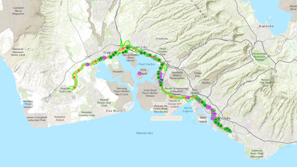
Historic Properties Map
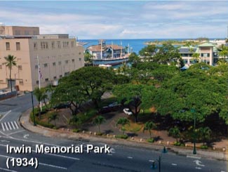
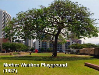
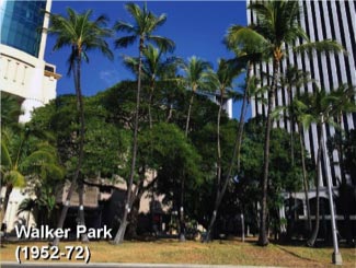
Irwin Memorial Park (1934), Mother Waldron Playground (1937), and Walker Park (1952-72) were all built in the early twentieth century, and are all adjacent to the rail guideway within the City Center Guideway and Stations.
As required and agreed upon mitigation for the adverse impacts from the Project, HART has prepared a Cultural Landscape Report (CLR) for each park. Each CLR documents the history and significance of the historic designed landscape as well as the historical and cultural contexts that influenced changes to the physical landscape. The CLRs also describe how these landscapes have changed over time, evaluates their integrity, and provides treatment recommendations for long-term management of these landscapes.
These reports were developed using the National Park Service (NPS) Secretary of Interior’s Standards for The Treatment of Historic Properties with Guidelines for the Treatment of Cultural Landscapes (1996), A Guide to Cultural Landscape Reports (1998), and other relevant NPS guidelines, standards, and National Register Bulletins.
The searchable Database of Historic Properties along Skyline and Future Station Areas is available to the public. Features include historic property descriptions, photos, PDF attachments, and other information.
Explore historic properties and associated data by selecting links and layers on this map.
Historic Properties Map
The searchable Database of Historic Properties along Skyline and Future Station Areas is available to the public. Features include historic property descriptions, photos, PDF attachments, and other information.
Explore historic properties and associated data by selecting links and layers on this map.
Educational Materials
Coloring Book
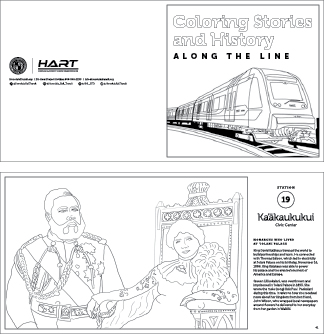
As part of HART’s educational outreach, professional historians and illustrators have prepared a coloring book to educate children about local history at each transit station. Featuring illustrations reflecting historical events or significant sites in Hawaiian culture, each page includes a brief written synopsis highlighting the area’s history. The coloring book will give children a broad historical knowledge of each built and planned station while fostering creativity.
Brochure
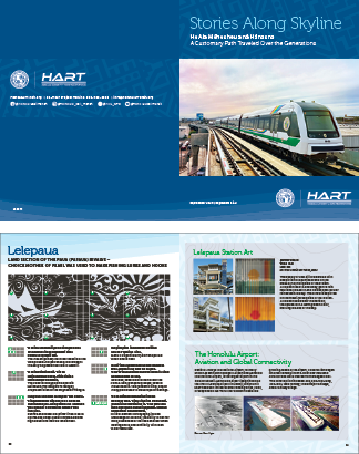
Stories along Skyline.
He Ala Mēheuheu a nā Hānauna.
A customary path traveled over the generations.
As part of HART’s educational outreach, this brochure describes the station names, the aesthetic column designs and artwork along Skyline’s first and second segments of the thirteen transit stations. It also provides details on the cultural aspects of each station and the significance of the area it is located.
Educational Field Guide
As part of HART’s educational outreach, professional historians are preparing three Educational Field Guides that showcase a variety of historic resources built along or near the Honolulu Rail Transit Project (AKA Skyline). These historic sites date from the mid-19th to the mid-20th centuries. The intent of the Field Guides are to share information with the public about the historic resources found along Skyline’s path, which will run from East Kapolei (Kualaka‘i station) to the Civic Center (Ka‘ākaukukui station) when completed.
PHASE A GUIDE
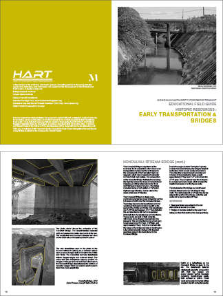
Early Transportation and Bridges
(Released April 2024)
This Field Guide focuses on historic transportation and infrastructure along Skyline’s route. It also provides a brief historical overview of Hawaii’s modes of transportation with particular focus on six historic bridges built in the 1930s: Honouliuli Stream Bridge, Waikele Canal Bridge, Waiawa Bridge, Waimalu Stream Bridge, Kalauao Springs Bridge and the Kalauao Stream Bridge.
PHASE B GUIDE
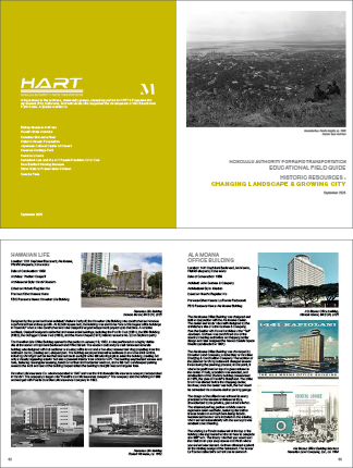
Changing Landscape and Growing City
(Released October 2025)
This Field Guide focuses on changes to Honolulu’s built environment over time. The guide covers several property types including military, commercial, residential, and office buildings, as well as various structures, agricultural land, burial grounds, and infrastructure-related resources.
Learn more About
HART Weekly eBlast
Our weekly newsletter will keep you up-to-date about the project, news, construction, and information on upcoming events.
Project Status
The Overall Construction and Design Project Progress is based on the Estimate at Completion for the 2022 Recovery Plan scope to Ka‘ākaukukui (Civic Center) Station and the March 2031 Operational Readiness date.


